
This hike was newly developed in 2010 and follows the route of the "old" Cabot Trail from Trout Brook to a view up Jerome Mountain. There are foundations and building remains visible along the trail, and the top features a final look-off with views of the ocean and Presqu'île. The trail is 9 km return, climbing from 130 to 360 ft, so not particularly steep or challenging. It is also not a loop, so the distance can be cut in half if one wishes to park a car at either end, one near the Trout Brook picnic area and the other at the other end, which is accessible from the road.
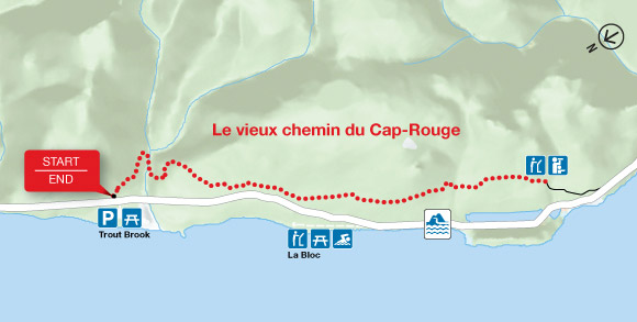 |
| Map - Le vieux chemin du Cap-Rouge © Parks Canada |
As far as hikes in the National Park go, this one doesn't make my list of favorites. Still, it's an enjoyable stroll and it's nice to see Parks Canada continue to develop the park.
No comments:
Post a Comment