Tuesday 13 August 2013

Aucoin Brook Falls


The ATV paths that run behind the town of Cheticamp grant somewhat easy access to a number of beautiful waterfalls. The plan for today was to do some of the ones that can be reached up LePlatin road, and though we only managed to get one in before we ran out of time, the day was not a disappointment.

LePlatin road can be found off the Cheticamp Back Road. From the Cabot Trail heading north toward Cheticamp, take the soft right at Flora's gift shop and take another right at LePlatin and park near the end. On foot, continue up the road and down the middle trail. We only had to cross the brook once to find the falls.

Some old building foundations can be found along the brook, and pieces of an old wooden dam remain at the top of the falls. If climbing them, keep your eyes open and don't trip on the metal ties in the rocks from when the dam was in use.


 Geocache in area:
"Aucoin Brook Falls" N 46° 36.306 W 060° 58.646 Status: Unknown (2013-08-11) GC36R4K

Magic Cove / Sight Point

It was only in my earlier twenties that I became much more interested in hiking in the areas up Route 19 (Inverness, Mabou, and such). By this time, I felt like I had done everything in the National Park ten times over and it was time to start moving south. By this time, the problem with Mabou was the spruce bark beetle, which devastated the woods along many of these trails, closing popular spots like Beinn Bhiorach, among others. Now that these trails are reopened, I'd like to spend more time up there. 


It you're interested in doing a few treks, a map of the Cape Mabou hiking trails system can be purchased at the Information Bureau in town and a few other places (the Bear Paw gift shop is one) for five dollars in the 2013 season. It was a toonie the last time I got one, but I wanted another in case anything had changed since the closings and reopenings of the trails that I needed to know about. I wanted to keep to the shore, so I did the MacKinnon's Brook trail today. I wasn't disappointed with all the cool spots I found, especially Magic Cove, which I had heard of being used for a picnic spot but had never seen.

So, we started from the Sight Point end by car. That is, at the southern end of the town of Inverness, turn left at the Tommy Cat Bistro and start climbing. Drive up a few kilometers to where the pave turns to gravel. HERE you may want to consider your driving strategy. Brave and with 4-wheel drive? No problem. Not so brave and driving your Civic? Meh. I wasn't worried about my car clearing the road itself. The problem is that the road eventually becomes a one-laner, and you just have to hope that any rigs meeting you will be able to take the ditch if your car can't. We met four vehicles, and Russell was driving. He had the courage to pull a lot closer to the sheer drop-off edge than I would have, and the vehicles we meet took the ditch with ease.


Magic Cove is a short detour from the MacKinnon's Brook Trail using the co-ords from the last geocache listed here. It's a very cool spot and not one to be missed.

Geocaches in area:
"Up the Sight Point Look-Off (#1 of Series)" N 46° 12.345 W 061° 21.523 Status: Good (2013-08-11) GCQDZJ
"CMHHT - MacKinnon's Brook Trail" N 46° 10.697 W 061° 25.678 Status: Unsure (2013-08-11) GC162KG
"Magic Cove 'Do you believe in Magic?'" N 46° 11.549 W 061° 24.732 Status: Wet (2013-08-11) GCXMCV

Mabou Salmon Hole


My connections in Mabou kept speaking of a swimming hole in the area that they wanted us to see, so this beautiful August afternoon Russell and I nephew-napped a kind seventeen-year old to show us the way down. Just after Mabou, take the Rankinville road and park on the side of the road near N46 03.196', W061 20.323. Look for the mobile home on the left side of the road. Someone does stay there, so don't park in their driveway, but the hike is just up there behind their place. Since we were with someone who heads up there quite frequently, I didn't stop and ask the lady for permission to tramp past her living room window, but a kinder soul might just do that.

I guess I underestimate the athleticism of young people, because I expected the swimming hole to be about twenty feet away--it's not. The trail winds through medium-length grass at first, then through mixed hardwoods for a distance. Look for the remains of the 'haunted house,' back there, said to be the site of an exorcism or two--though, truly, I think half of the old farm houses in Mabou have that reputation. Shortly after the home you'll start the descent. Here is where I realized this is definitely hiking-shoe or sneaker territory. Thinking only of the swimming, I had brought sandals and this is more of an Egypt-Falls-type walk than a trek to the beach. The journey is not long, but it's a steep ascent on the way back out. NOTE: Keep an eye out both ways for barbed fencing. I wish we had brought snips, because that stuff's not fun to get in the leg and I don't think there's any animals grazing down there anymore.

The salmon hole itself boasts the warmest water I've ever seen coming from a brook. This may have been the reason it was once spawning ground (not sure). When the sun is at it's highest point, the fantastic rock formations and old concrete around make a great sunbathing spot, with lots of dry flat room to stretch out. After noon, the treeline provides shade for the near side of the pool, with the far side getting sun through most of the day. All in all, a very great spot without the overwhelming popularity that some of my other favored swimming holes get (Gypsum Mine in Cheticamp, for example, which often seems to have too many people).


Where Dylan is (right) is a perfect jumping-off point.


Thursday 11 July 2013

Cape Clear


Ella doesn't ordinarily get to ride in the back of a truck, so this was fun for her. 

Cape Clear is one of Margaree's finest attractions that we keep to ourselves by giving horrible directions. We know how to get there, but we often give absolutely horrible directions to those who don't.

 You've got to check out Cape Clear! It's the most beautiful spot in the world! How do you get there? Well, first you've got to get to the Highlands. Nope, not the Cape Breton Highlands park. What we call the Highlands is also the logging dirt road system back here. No, you can't trust that there will be signs, though there usually are. Nope, it won't pop up on your car GPS. No, it's not on google maps. No, you better not use your Garmin, because it'll probably take you up the wrong road before you get to the right one. Umm. Sorry. And make sure you keep track of every turn you make, because although the roads are in great shape, you  could spend days lost on those logging roads. Good luck!


But its actually way easier than it sounds. Any Department of Natural Resources office can give you a DNR map of the region that you can follow if unsure. From Margaree Valley, take Fielding Road until it turns left, becoming Highland Road. This road is wide and in great condition (at least by Margaree standards). People tend to fly on it, and it's one of the few dirt roads I've ever seen with a speed limit posted of 80 km, which can be done comfortably. I'd remain wary, though--if you stay on route to Cape Clear or some more popular destination, fine, someone will most likely find you if there's any trouble, but if you make a few wrong turns and get a flat tire, you might be left to your own devices for some time.


Some signage exists on Fielding and Highland Road, but the roads off these more major routes are typically not marked.  Stay straight on Highland Road for about 10 kilometers until you see the road marked Cape Clear on the left. Then drive to its end. Park whenever you begin finding it unsafe to drive, or when you see signs hanging from the trees that say "caution."


From there, behold--a magnificent view of the Margaree Valley from on top of a sheer drop-off of several hundred feet. See the Margaree river, the province's premier salmon spot, winding below you and looking like a bit stream from this height. On the right day, eagles can be seen soaring among the mountains.


Geocaches in area:
"Cape Clear" N 46° 28.359 W 060° 53.249 Status: Good (4/6/13) GCH2KC

Sunday 30 June 2013

Camp Carter & Falls

Camp Carter is built on an old farmstead near the town of New Harris, Cape Breton. To get there, it is just a short drive up Big Harbour Road, on the north side of the Seal Island Bridge. There are a few geocaches near the main campground that you may wish to check out, as well as ample parking. From there, the trail-head to the actual falls trail is just a short walk back in the direction you came from. To your right, you'll see a small waterfall, with the larger being across the road and a short jaunt up.

Lower falls, as seen from the opposite side of the road to the trail that leads to the main falls.


There is a rope to help you climb above the main falls.


While I don't wish to plaster my own face all over this blog, I happened to not get any good photographs of the falls that didn't have Russell or myself in them. I've seen a few photographs online that show the falls during times of low water, but we were lucky enough to see it on a powerful day after a few days of rainfall. 

 
Geocaches in Area:
"Camp Carter 'Scouts'" N 46° 13.783 W 060° 31.012 Status: Good (2013-06-30) GC2K8XQ
"Camp Carter 'Cubs'" N 46° 13.716 W 060° 31.105 Status: Good (2013-06-30) GC2K8X9
"Camp Carter 'Beavers'" N 46° 13.620 W 060° 31.027 Status: Good (2013-06-30) GC2K8RX
"I Fall 4 U" N 46° 13.645 W 060° 30.891 Status: Good (2013-06-30) GCJPB8
"Camp Carter Falls/Steeves Memorial Scouts #5" N 46° 13.645 W 060° 30.922 Status: Good (2013-06-30) GC1WAQP
"On a hippie trail, head full of zombie" N 46° 13.538 W 060° 30.880 Status: Good (2013-06-30) GC3TYQN
"Be Prepared" N 46° 13.694' W 060° 30.656 Status: Good (2013-06-30) GC3DTDJ


Monday 24 June 2013

Shean Trail: Kenloch Church to Black River

For an introduction to the Shean segment of the rail-trail, see my post: Shean Trail: Inverness to Kenloch Church. It was written in much better humor than this will be, and reading both may provide a better spectrum of experiences to be had on the TCT (the Trans-Canada Trail).

As mentioned in that last post, I use the TCT in Inverness County primarily for biking. Just shy of a 100 kilometers and built on a stripped rail-bed, the trail is long and flat, and might be considered quite boring on foot. Once you know it well, you can do it in segments, and choose your favorites (i.e. start in Mabou, and do the couple of kilometers that are near the Mabou Rivers, and so on). Even so, if you are by yourself and haven't a second vehicle parked at your end-point, you then have to turn around and walk the same, flat hike back--very different from mountainous hiking, where at least you'd have the different viewpoints and experiences of walking either down or up from where you turned around. While on a bike, I still have to return by the same route (or switch to the highway, though I'm not much of a road-biker), but at least I'm covering more ground in the time I have.

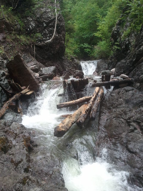
In any case, I had the bike with me today to cover the stretch from Kenloch Church to Black River, which I hadn't done in a couple of years. I was in rather pissy cheer to begin with, and this route just cemented that for me. We had received a bit of rain over the last few days, but no floods or wash-outs, so I didn't anticipate this to be a problem before leaving. Once I began, however, I found that this segment of the trail had recently been re-graveled in many spots. The top was soft, and made for a much more arduous bike-ride than I anticipated. Coupled with the maddening presence of every mosquito and black fly imaginable, it was a rough day that I thought couldn't be made any worse until I hit a "good" patch of trail, started speeding up, and then flew into a hole at the wrong angle at the end of this bridge under repair.


But HA! Things can always become worse. After biking to a few geocaches that were hidden in areas of extreme mosquito concentration and of no considerable sightseeing worth, and after putting in some considerable effort on soft ground, I met a couple of dump trucks on the trail. The trail is just wide enough for these vehicles, and grooming or maintenance can take place at anytime. Shortly after meeting them, I turned around, expecting my ride to be the same (not good, but not worse). And...of course, the trucks were out dumping more fresh dirt. Even keeping my tires upon their own flattened tracks, it still felt like biking on a sandy beach--brutal.


There was only one pleasant factor to today's segment--the lovely breeze that followed me along Lake Ainslie at the beginning and end to my ride. While it didn't exactly blow my frustrations away, it did dry my sweat and blow the mosquitoes off my neck.


Geocaches in Area:
"Hurricane Series":
N 46° 11.093 W 061° 16.326 GC2ET2V
N 46° 09.423 W 061° 16.678  GC2ET2Q
N 46° 08.544 W 061° 17.763 GC2ET2K
N 46° 07.993 W 061° 18.939 GC2ET2F
(Statuses: All good 2013-06-24)

Thursday 20 June 2013

Silver Fox Falls

Yes! A must-do! Soon after a mildly painful walk into Righwash Brook Falls (not because of its length but because of high water, rain, rock scum, and the decision to go at twilight), I suggested we do Silver Fox Falls. I was truly hoping that this would be a better and easier experience since we were just intending on a short evening trek, and I was not disappointed. It's easy to find, easy to get to (despite a small amount of brook-navigating), and easy to enjoy.

Near the old (and now closed) Cheticamp Building Supplies, lies an old dirt road at N46 34.798 W061 01.365. We were driving the Civic so parked at the home on the hill and followed the trail. An ATV would be able to continue on and drive almost right to the falls.


A natural tub--a small pool just above the falls, surrounded by rock.

Hopping up to the top of the falls is surprisingly easy--both of us had no trouble, even without rope, since there were a lot of footholds.


Geocaches in Area:
"Silver Fox Falls" N 46° 34.292 W 060° 59.845 Status: Probably missing (2013-06-20)


Tuesday 18 June 2013

Random Road: Lake Ainslie Edition

Most seasoned service workers in Inverness County (wait staff, gas pumpers, etc.) have been asked this question by a tourist--"So...what do you do around here for fun?" The question points to our rural existence in a way that I used to find slightly offensive, wanting to respond with the same things most of you do. We go to parties, we make love, we eat, we watch a film now and then. But I get it, I do. We're a bit off the main grid. If I had time, I sometimes answered the visitor with a list of my own hobbies. If I didn't, I replied with "Oh, when you're curious, you find lots of things to do." I stopped relying on that answer when I found out it that it was also a quotation attributed to Walt Disney, but it's still an idea that I hold on to when I find myself alone on a day off from work, all my menial chores are accomplished, and I can't sit still to read. When those circumstances arise, it is time to be curious. Checking out every dirt road in the county, followed by their branching paths, creates enough activity to fill many summers worth of such days.

Thanks our natural industries, there's an almost infinite number of dirt roads in our county. The following is an image of Lake Ainslie as seen from a short distance up a gravel pit road located at  
N 46 11 004 W 061 14 370 (about ten minutes up Deepdale Road from Inverness). I caught this view today while searching for a geocache a short climb from the road's end. The view was great, and the black flies minimal.The geocache itself was less rewarding, having been blocked in by thick alders that have grown up since its placement.


Geocaches in Area:
"Mounting the Lake Ainslie Haven (RR #2)" N 46° 11.195 W 061° 14.024 Status: Area grown in (2013-06-18) GCVWTT.

Thursday 13 June 2013

Le Chemin du Buttereau

Le chemin du Buttereau is an old trail that connected the community of Le Buttereau to the neighboring village of Chéticamp from the late 1700s until the Cabot Trail opened in the 1930s. At 4.6 kilometres return, it's not an overly long hike and makes a nice walk on a hot day if you wish you spend some time out of direct sunlight. It rises from 25 to 65 m (80 to 215 feet), so it's not the steepest trail, though there's one a small climb in sections. The term "buttereau" actually means small hill, and this slight rise will take you above the Cheticamp River and Gulf of St. Lawrence for some nice views. The trail is self-guilding, winding through mixed Acadian forest and around old foundation ruins. Beginning at its southern end or first entrance, you'll feel at first as though you're heading back towards Cheticamp, only to begin curving to the north right away. 


The remains of old foundations that you pass belonged to the families who lived here, including David à Sambo and Rose Chiasson (and their 10 kids), Georges à Cacoune and Josephine LeBrun (and their 10 kids), Séverin à Édouard and Nélée LeBlanc (and their 10 kids), Joseph à Cacoune and Marie Deveau (and their 11 kids), and Auguste à Édouard and Hélène LeBlanc (and their 9 kids). The names following the husbands are those of their fathers. After a few old remains, you'll notice the covering to an old well to the left.


When you reach an intersection where you can go left or right, you have reached Le Buttereau, the loop part of the trail. It's well worth it to catch the views from these look-offs. During the fishing season, you can see boats out here. An informative panel along the trail tells us that the original inhabitants of Le Buttereau would head to La Bloque or Chéticamp Harbour to meet with the boats, and stay for the week before returning home. At 50 cents for 100 lobsters, they were only eking out a living for themselves.


Though you can loop around Le Buttereau, finishing it til its end will you give you the following views. When you get to the opposite end of the trail, you'll be looking at the Grand Falaise (the Big Cliffs).


The parking area at the Grand Falaise is where you might wish to begin another excursion that I discussed on another day, a waterfall that is very rewarding if you're careful to get there--Righwash Brook Falls.