Tuesday 13 August 2013

Aucoin Brook Falls


The ATV paths that run behind the town of Cheticamp grant somewhat easy access to a number of beautiful waterfalls. The plan for today was to do some of the ones that can be reached up LePlatin road, and though we only managed to get one in before we ran out of time, the day was not a disappointment.

LePlatin road can be found off the Cheticamp Back Road. From the Cabot Trail heading north toward Cheticamp, take the soft right at Flora's gift shop and take another right at LePlatin and park near the end. On foot, continue up the road and down the middle trail. We only had to cross the brook once to find the falls.

Some old building foundations can be found along the brook, and pieces of an old wooden dam remain at the top of the falls. If climbing them, keep your eyes open and don't trip on the metal ties in the rocks from when the dam was in use.


 Geocache in area:
"Aucoin Brook Falls" N 46° 36.306 W 060° 58.646 Status: Unknown (2013-08-11) GC36R4K

Magic Cove / Sight Point

It was only in my earlier twenties that I became much more interested in hiking in the areas up Route 19 (Inverness, Mabou, and such). By this time, I felt like I had done everything in the National Park ten times over and it was time to start moving south. By this time, the problem with Mabou was the spruce bark beetle, which devastated the woods along many of these trails, closing popular spots like Beinn Bhiorach, among others. Now that these trails are reopened, I'd like to spend more time up there. 


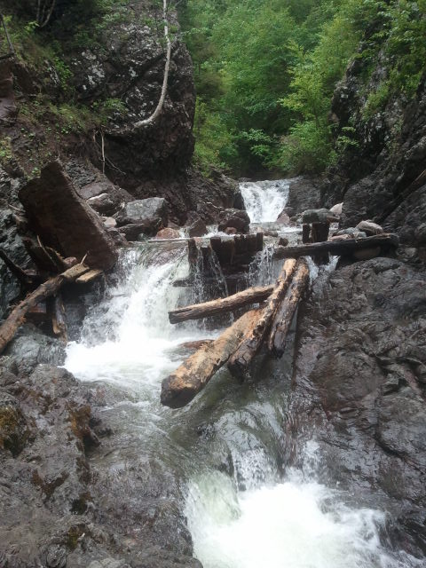
It you're interested in doing a few treks, a map of the Cape Mabou hiking trails system can be purchased at the Information Bureau in town and a few other places (the Bear Paw gift shop is one) for five dollars in the 2013 season. It was a toonie the last time I got one, but I wanted another in case anything had changed since the closings and reopenings of the trails that I needed to know about. I wanted to keep to the shore, so I did the MacKinnon's Brook trail today. I wasn't disappointed with all the cool spots I found, especially Magic Cove, which I had heard of being used for a picnic spot but had never seen.

So, we started from the Sight Point end by car. That is, at the southern end of the town of Inverness, turn left at the Tommy Cat Bistro and start climbing. Drive up a few kilometers to where the pave turns to gravel. HERE you may want to consider your driving strategy. Brave and with 4-wheel drive? No problem. Not so brave and driving your Civic? Meh. I wasn't worried about my car clearing the road itself. The problem is that the road eventually becomes a one-laner, and you just have to hope that any rigs meeting you will be able to take the ditch if your car can't. We met four vehicles, and Russell was driving. He had the courage to pull a lot closer to the sheer drop-off edge than I would have, and the vehicles we meet took the ditch with ease.


Magic Cove is a short detour from the MacKinnon's Brook Trail using the co-ords from the last geocache listed here. It's a very cool spot and not one to be missed.

Geocaches in area:
"Up the Sight Point Look-Off (#1 of Series)" N 46° 12.345 W 061° 21.523 Status: Good (2013-08-11) GCQDZJ
"CMHHT - MacKinnon's Brook Trail" N 46° 10.697 W 061° 25.678 Status: Unsure (2013-08-11) GC162KG
"Magic Cove 'Do you believe in Magic?'" N 46° 11.549 W 061° 24.732 Status: Wet (2013-08-11) GCXMCV

Mabou Salmon Hole


My connections in Mabou kept speaking of a swimming hole in the area that they wanted us to see, so this beautiful August afternoon Russell and I nephew-napped a kind seventeen-year old to show us the way down. Just after Mabou, take the Rankinville road and park on the side of the road near N46 03.196', W061 20.323. Look for the mobile home on the left side of the road. Someone does stay there, so don't park in their driveway, but the hike is just up there behind their place. Since we were with someone who heads up there quite frequently, I didn't stop and ask the lady for permission to tramp past her living room window, but a kinder soul might just do that.

I guess I underestimate the athleticism of young people, because I expected the swimming hole to be about twenty feet away--it's not. The trail winds through medium-length grass at first, then through mixed hardwoods for a distance. Look for the remains of the 'haunted house,' back there, said to be the site of an exorcism or two--though, truly, I think half of the old farm houses in Mabou have that reputation. Shortly after the home you'll start the descent. Here is where I realized this is definitely hiking-shoe or sneaker territory. Thinking only of the swimming, I had brought sandals and this is more of an Egypt-Falls-type walk than a trek to the beach. The journey is not long, but it's a steep ascent on the way back out. NOTE: Keep an eye out both ways for barbed fencing. I wish we had brought snips, because that stuff's not fun to get in the leg and I don't think there's any animals grazing down there anymore.

The salmon hole itself boasts the warmest water I've ever seen coming from a brook. This may have been the reason it was once spawning ground (not sure). When the sun is at it's highest point, the fantastic rock formations and old concrete around make a great sunbathing spot, with lots of dry flat room to stretch out. After noon, the treeline provides shade for the near side of the pool, with the far side getting sun through most of the day. All in all, a very great spot without the overwhelming popularity that some of my other favored swimming holes get (Gypsum Mine in Cheticamp, for example, which often seems to have too many people).


Where Dylan is (right) is a perfect jumping-off point.