Monday, 27 May 2013

Salt Mountain


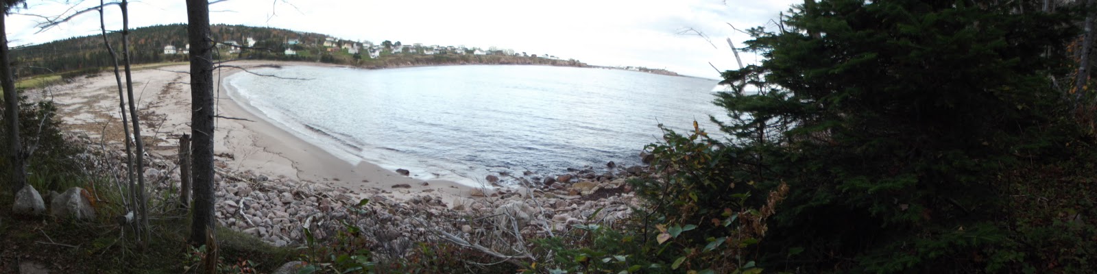
Just a preview of the Bras d'Or lake on the way up.
A "Provincial Park" in our end of Nova Scotia can mean almost anything--often no more than a roadside picnic table with a garbage can. That's all one needs for outdoor shenanigans, really--though do please consider the pending arrival of the gatekeeper when you are engaged in anything lewd at twilight. That said, the Whycocomagh park stands out as an exception. On my last visit, the day-park or camping section was a bit too overgrown to land in a list of top destinations, but that can likely be attributed to PM Harper and the shortened park seasons forced by budget cutbacks. The hiking itself was a delight.

The Bras d'Or Look-off
The Whycocomagh park can be found just past the main town heading in the direction of Sydney. While there was only a short trail accessible there as of a few years ago, the insatiable hiker can now spend hours in the park, with just about ten kilometers of trails between the initial "Highlander" trail and up the more rugged "Scout" trail. The trailhead is across from the DNR Office, right after the campground entrance--close enough to Highway 105 to be a decent spot for tourists to stop.


Me, 'pretending' I can't handle the steepness?
The Highlander and Salt Mountain trail portions total about 3 and a half kilometers, so the initial section of trail is not long. It does climb 750 ft above the Bras d'Or Lake in no time, though, so it presents a little bit of a challenge. Continuing on with the Scout trail is trickier.  If you're lucky, as I was, you'll hear the shouts and cries of tubby little kids ahead of you to keep you going. Children, surprisingly, seem to have no difficulties with this one.


Whycocomagh means "Head of the Waters" in Mi'kmaq, referring to the area surrounding Salt Mountain. Across the bay from the Provincial Park lies the Mi'kmaq reserve.


Geocaches in area:
"Whycocomagh Provincial Park" N 45° 57.963 W 061° 06.606 Status: Good (6/3/13)
"Salt Mountain-Whycocomagh Village Lookoff" N 45° 57.954 W 061° 05.750 Status: Good (6/3/13)
"Salt Mountain-Bras d'Or Lake Lookoff" N 45° 57.840 W 061° 05.741 Status: Good (6/3/13)


Thursday, 16 May 2013

Coastal/Jack Pine

The Coastal and Jack Pine trails near Neil's Harbour are a definite treat whenever I can make it that far. There are two trail-heads for this one, one at Black Brook Cove, and the other nearer Neil's Harbour. I had begun on the Black Brook end some years ago, so decided to pursue the other, northern, end. After a bit of confusion, I managed to get my bearings. Check out this map.

I don't know what the rationale is behind this Parks Canada map, but putting north on the bottom just...stinks.
Here's a map from my car, complete with coffee stains.
Doing both the Coastal and Jack Pine trails includes about 13 kilometers, following the Atlantic Ocean from Neil's Harbour to Black Brook, elevating from sea level to over 100 ft. What I really enjoy about this trail is the mixed terrain, hiking amongst hardwoods, windy shoreline, crushed rock, etc. 


I caught sight of a number of gannets diving for fish, but took no clear pictures worth showing.


We were all alone out there, so Ella got to run free.


Half way through the Coastal Trail is the connection with Jigging Cove Brook trail. It's only 1.4 kilometers, so I decided to do it again, but was immediately reminded of why I told myself I should not have bothered with it the last time. It was very wet and boggy, as demonstrated here.


After a long day, I kind of wished I hadn't added an additional almost-three kilometers. In any case, when you start at the opposing end you have the opportunity to close with the Jack Pine loop, which is fairly short and easy and has only small gains in elevation.

Sunday, 12 May 2013

Le Vieux Chemin de Cap Rouge


This hike was newly developed in 2010 and follows the route of the "old" Cabot Trail from Trout Brook to a view up Jerome Mountain. There are foundations and building remains visible along the trail, and the top features a final look-off with views of the ocean and Presqu'île. The trail is 9 km return, climbing from 130 to 360 ft, so not particularly steep or challenging. It is also not a loop, so the distance can be cut in half if one wishes to park a car at either end, one near the Trout Brook picnic area and the other at the other end, which is accessible from the road.

 
Map - Le vieux chemin du Cap-Rouge
Map - Le vieux chemin du Cap-Rouge © Parks Canada
 As far as hikes in the National Park go, this one doesn't make my list of favorites. Still, it's an enjoyable stroll and it's nice to see Parks Canada continue to develop the park.

Sunday, 5 May 2013

Fishing Cove

Fishing Cove is another hike "down"--which is why a lot of hikers choose to take the long way in, and the short way out, which is all uphill. The longer route follows more water, which is something you might want to keep in mind for a pet. Parks Canada lists the longer route at 12 km return, and the shorter at 5.7 km. Both trail-heads can be found at the top of MacKenzie Mountain

Map - Fishing Cove
Map - Fishing Cove © Parks Canada

At the bottom, you'll be at a small ocean cove, and have the option of swimming in either fresh or salt water. This is also the site of the National Park's only "wilderness camping" site--something I've never really been interested in myself, because the park does not allow open fires on the site. If you were interested in camping here, it's pertinent to know that the walk back out is very steep, from sea level to 1,165 ft, and there are no garbage bins on site--everything must come back out with you. Registration must be made at either the Cheticamp or Ingonish centers. There is also no potable water on site. Those who do camp here seem to love it, and love the sunsets and sunrises of the ocean panorama, but there are other spots where I feel I can have the "wilderness" feeling and not sacrifice my campfire. 

When I do go to Fishing Cove, I definitely spend some time at the beach, or midway point of a return trip. It's often nice and cool by the water, and knowing what the trek back up has in store, I'll take my time. There are fishing opportunities here as well, though anglers should contact the Cheticamp or Ingonish offices of the park for permits and to confirm restrictions, since regulations in the park differ from the waters outside of the park.


Absolutely terrible, but this is the only picture I have in my stash of Fishing Cove at the moment.

Sunday, 7 April 2013

Gillis Falls

For those days when you might be a bit too tired for the exertion required by a bona-fide hike, there are many opportunities in Cape Breton for a quick stop at a look-off or waterfall. The CBRM's Gillis Falls are impressive for their pristine quality and relative closeness to our urban center. To get there, head towards Eskasoni First Nation from Sydney by taking exit 6W off Hwy 125 onto Hwy 4, and about 12 kilometers later right onto Hwy 216. Another right turn just over a kilometer later will take you onto Gillis Lake Road. From there, head north for about 3.5 km, and park on the side of the road just before the small bridge. The first waterfall, and a nice swimming hole, are on the lower side of the bridge. The approach is steep but short.


A trusted pair of insulated rubbers takes a person into the cold water without a problem.
The second falls are on the other side of the bridge, so you'll want to ascend back to the road. These are on private property, so you may want to drive up a little further to his driveway and ask the owner's permission before venturing forth. This driveway features a bridge--look down, and you'll see that you are now on top of the second falls. The owner wasn't home when we ventured over, so we decided to head down anyway, returning our car to its first parking spot and hopping the gate seen here on the upper side of the bridge. If you happened to be carrying your fishing gear and a Nova Scotia license, you would be allowed to access water via private property in any case.


An impressive flow of water right below the owner's driveway.
On our way back out, we met a man (not the owner), who said the landowner didn't mind people going to the falls as long as they weren't destructive, and that the "No Trespassing" signs were more or less intended to protect himself from people getting hurt on his property. It being early April, and with a fair amount of snow still on the ground, we didn't stick around for a picnic, though the falls' proximity to Sydney has me thinking that a favored takeout might be an enjoyable treat to bring next time.

Geocaches in area:
"Two Falls for the Price of One" N 46° 02.957 W 060° 23.56 Status: Good (4/6/13) GCJ7EY

Thursday, 21 March 2013

Broad Cove, Baby! (Or, Broad Cove with Babies)

Just as Hollywood is full of actress/waitresses, so, I imagine, is rural Cape Breton full of artist/EI recipients. Within that second umbrella may be included the unemployed-artist-turned-babysitter. And in THAT umbrella falls the unemployed-writer-babysitter. And at the very bottom of THAT umbrella, at the outside, getting soaked a bit, is the unemployed-wannabe-writer-turned-babysitter. See her? She's blogging while the kids in her care are putting screws they found on the floor in their mouths. Good god. Disaster averted.

Alright, so my current work situation is laid out on the table now. Since this blog is about outdoor adventures, and I currently have children on the mind, I thought I'd take the time to consider some of the safer places I've been to lately--places I might actually be able to take a child to (NOT, for example, Gypsum Arch Cave, or some place with a lot of bushwacking). A short trail in Broad Cove immediately comes to mind. I'd give it a difficulty of 2 for most adults, so...maybe an 8 or a 9 for people who are handicapped with children. One section involves walking across rocks at the beach, and this might be a piggy-back opportunity for them. Or bring band-aids. They've gotta learn sometime.

Where you'll want to end up is on a hill stretching out into the water. From there, look back, and wow! Here, you are out far enough that you have a really great panoramic view of several peaks of shore from Inverness towards the Margaree. The first time I was here, I came by way of walking through thorns from the Broad Cove wharf. As it turns out, there's a much easier trail--and this, of course, is where you'd want to go. In Dunvegan, take the dirt road that leads to MacLeod's Campground (to your left if you're coming from Inverness and heading towards Margaree). The trail is just past the campground, on the side of the water. It's easy to miss it while driving, so keep out a keen eye, or use your GPS to get to N 46 18 241, W 061 15 010. Park right on the road, and begin walking up the trail.

Follow the trail for a short time (or, with the kids, a medium-length of time) and you'll be led to a rocky beach. To the right are the rocky jagged peaks that you'll soon have a great view of. To the left is the grassy hill that juts out into the ocean. This is where you'll want to head. Once again, crossing these rocks is probably a task unmanageable for toddler-age children on their own. When you all get to the top of the hill, you'll be on a plateau overlooking what feels like the entire coast of Inverness County, from Inverness to Chéticamp. The view is all one needs, but if you did bring your GPS, there happens to be a geocache here as well.


I happen to enjoy walking at dusk, and right before the skies open up, so the pictures I have from my last time here are quite dark--possibly not the best time to take the little ones. This is the view towards Chéticamp. 


Geocache: "The Pinnacle of Cape Breton" N 46° 18.267 W 061° 15.290 Status: Good (21/3/13)

Thursday, 14 March 2013

Pollet's Cove: Solo in March

Yesterday I found myself talking to some friends about Pollet's Cove, and I shared the story of my solo journey there. It wasn't something I'd like to repeat any time soon solo, but since it was approximately a year ago, it seemed proper to commemorate the anniversary of my foolishness with some documentation on the adventure. 

It was March, and I had a week's vacation beginning on a Friday afternoon. More important than the vacation is the naked truth that I was suffering from a broken heart. What's a gal to do? I nixed the idea of drinking myself into a stupor, packed everything I could, and headed in my Honda Civic to Red River, Pleasant Bay for a weekend trip to Pollet's Cove. What could go wrong?

But, oh yeah--I DON'T OWN ANY WINTER CAMPING GEAR. And the nights are still VERY cold in Pollet's in the winter. And to tell the truth--I don't know if I would have made it in with winter gear. As it was, I felt every SINGLE pound that I carried. I was frustrated and depressed at home, and--in some bizarre moment of mis-enlightenment--Pollet's presented itself to me as a fixing opportunity. I cared not for the fact that my extra-big camping bag had gone missing. Or that my tent was a thin piece of Canadian Tire merchandise from years ago that barely held up in July. Or that there was a cold North wind being predicted for that entire weekend. I was going, even if I had to carry my food and water in co-op bags...which I did.


The great thing about the hike to Pollet's Cove in March is that its' first long, winding ascent will leave any hiker completely unaware of the cold outside. On the flip side, of course, is that it is a LONG, WINDING ASCENT and you'll be doing it with camping gear and food. I had SOME luck with this, as my co-op bags broke open about halfway through my journey. In the dash to save them, I lost my gallon jug of water. YES! I thought! I just lost 3 lbs of weight! I kept two cans of beans, a bag of trail mix, and ONE 500 ml. bottle of water. With no room and no hands left to carry anything else, I took a break and gave my dog anything that couldn't come with me.

I was estimating a three-hour hike in, and was shocked when I thought I arrived there after only an hour, seeing shoreline and a pretty brook. But nooo...I could see the trail continuing after this spot. This was Otter Brook, only halfway in and devastatingly high with the early spring run-off. I walked up and down its sides, trying to find a safe place to cross. It took me no less than fifteen minutes. Just two weeks later, I would learn that a group of hikers was stranded on the other side when they met high water on their return. And I was doing this BY MYSELF. Really, what was I thinking? If I fell in there and couldn't catch myself, who was there to help me?

But I made it, wading in the March water up to my knees, soaking my boots, and immediately developing blisters once I continued my walk--yes, yes, you should always bring a second pair of shoes--but I couldn't face the thought of carrying anything more in with me. The hike was difficult enough that I had to wear two sweaters and a jacket around my waist. These kept coming untied, and every time I had to bend to pick them up, I'd come close to topping over.

There was never a happier girl in the world than the one who reached Pollet's Cove that evening. Naturally, it was deserted that time of year. No campers, and the wild horses were not yet parading on the beach. I took one picture at this time, and pictures do the scene such little justice that I post it quite reluctantly.


Having left in the afternoon, it was becoming dark. I sat here for only a moment and headed down this last hill to the beach to collect firewood. It was now that the reality of what I had done began to sink in. Sure, I had made it to Pollet's Cove. But now I was going to stay here ALL. BY. MYSELF. Coyotes in the distance began to howl. Shit. Shit. Shit.

What was truly awesome at this point is that my only pair of good winter gloves had become soaked in my trek through the brook, so I was down to a pair of thin mini-gloves while the first pair dried out. By now, the hot hike was completely forgotten and I was shaking with the cold. I'd warm one hand at a time by tucking it into my armpit while I'd gather one or two pieces of driftwood with the other arm. By the time I had a pile of wood, it was dark, and I had to set my tent up with only the light of the fire. The lack of preparation I had made for this trip was alarming--in truth, I had gotten home from work in Cheticamp at four p.m., and was making the hour-plus drive to the head of the trail by four-fifteen. The ONE smart thing I did was bring fire-starter cubes. At the very least, my fire gave me no trouble.

What then? It was night. There were wild animals. I was scared. I took off my boots, put them by the fire to dry, and tried to get comfortable in my tent. With only one summer-weather sleeping bag and a thin acrylic blanket, I spent the night in the rigid, back-aching posture of the perpetually frozen. Occasionally, I would consider moving to add wood to the fire. Consider, only. I was so damn cold I could not move.

I woke up for good around 4 a.m. and started a new fire, building my stick pile in the same way I had done the previous night, with one hand always tucked into my arm pit. My fingers were numb and white as snow, even with my 'better' mitts dry. I knew that if I could handle waiting around until noon or so, it should warm up a bit under the sun. But there was still a cold North wind to face, and I was feeling more lonely than I ever had before. I wanted a hot coffee and a warm place to sleep. I could not stay here.

The interesting thing about the Pollet's Cove hike is that it seems to be one of those uphill-both-ways journeys. There's a steep incline on the return trip as well, though the journey is overall much easier. It still didn't take me long to reach the decision to burn most of what I had carried in with me. The sleeping bag, blanket, tent, two of my sweaters, and the axe become food for the fire. With those gone, I made it back to Otter Brook in excellent time. Again, it took me a while to find a safe(er?) place to cross--this time about twenty minutes--but I still made the return trip in just over an hour.

This was the third and final picture I took of my journey, taken after sunrise. Since most of my time there was in darkness, I have very little evidence that the experience even occurred--though I am reminded every time I have to borrow a tent.

When I saw my car again, I did feel a pretty big pang of regret at having burnt most of camping equipment, however decrepit it was. In the end, however, I got my coffee. More importantly, I lived to tell the tale and indeed overcame my broken heart.

I'm now looking forward to a return trip to Pollet's Cove--but with two conditions. It will be in the summer, and I must have either a travel companion or the assurance that there will be people out there.

Then again, maybe my heartbroken other half will make another appearance some day. That bitch is always up for anything.